Hi All!
We went out last Monday. It was an interesting day as here in the South along the Eastern Seacoast.
Her we get these afternoon “maybe” thunderstorm cell trains.
“Maybe” they will show up?
“Maybe” they won’t?
“Maybe” they will be in our area?
“Maybe” they will be someplace else?
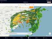
The forecast generally has it being 5% chance of precipitation all day till around 3-to-4 PM when it jumps to 80% !!!
The storm cells are strung out in a line and move up from Georgia along the coast…sometimes right on the coast and other times 30 miles inland and sometimes both….and sometimes they just fade away to nothing…. Go figure….eh?
So after watching the forecast and radar projections that early morning it looked like there might be a clear afternoon.
Then at mid morning it looked like “maybe” there might possibly be a storm cell but well inland and south of us.
Then at noon time it looked clear again… so we decided to go out and head north.
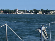
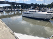
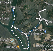
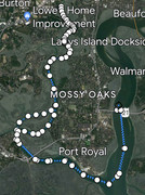
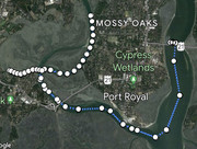
We left the marina slip and headed north up the Beaufort River at low slack tide motoring past Downtown Beaufort and the swing bridge.
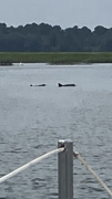
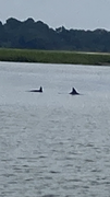
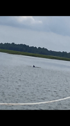
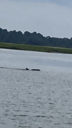
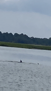
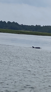
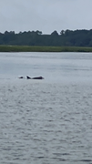
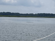
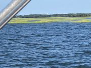
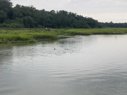
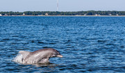
Some dolphins visited with us by the Pigeon Point Landing. The skies were clear and blue. The waters calm and peaceful


.
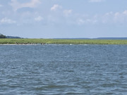
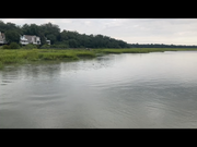
We continued up river to Brickyard Landing where we turned left to explore the McCauly Creek estuary.
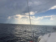
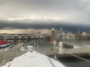
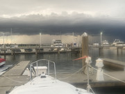
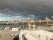
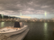
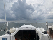
As we turned to exit there on the horizon we noticed building clouds to the south of us.
Using the benefits of modern technology we checked the weather app to find that there were a whole series of storm cells strung out to our south. One of the stronger cells was currently sitting on top of our slip at Port Royal. Hmmmm…
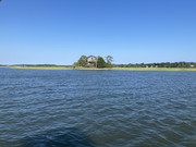
Plan B - Now would not be a good time to head back so we headed further north onto the Coosaw River while periodically watching the radar weather forecast.
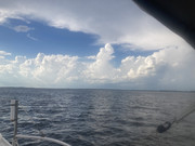
It didn’t take long to figure out that the string of gathering storm cells were building, getting stronger and rapidly moving north…hmmmm.
Time to go to Plan C - We headed down the Coosaw River toward Sam’s Point Landing by ICW Marker 189 which should put us out of the “train” of storms…. Right? Hmmmmm….Nope.
Plan D - Time to head further north up to the turn toward Edisto Island at ICW Marker 186. Upon reaching that location the weather radar showed that it wouldn’t be a great idea to be in narrow channels as the storm train track would be right on top of it…. Hmmmm… Nope.
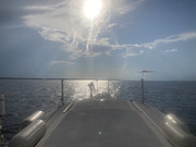
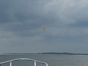
Plan E - Head further down the Coosaw River which would take us east toward the Atlantic. While this path was no longer on the ICW the river was much wider providing maneuvering space while taking us further away from the storm track. We continued into the St Helena Sound to where we could see the Combahee Bank Light Buoy. This area gets a bit dicey as all the charts warn that area is ‘Subject to Continual Change’.


🫣 Checking the horizon to our south and the weather radar there was a sigh of some limited relief. The storm cells seemed to be disapating. It was now approaching 5:45 PM. There was a reasonable gap now that would allow us to return to our slip. Timing is everything.

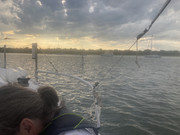
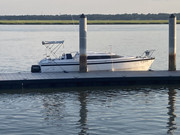
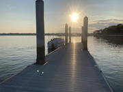
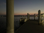
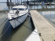
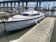
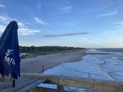
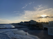
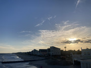
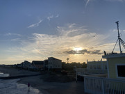
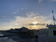
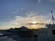
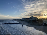
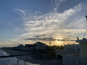
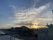
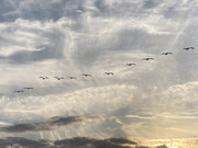
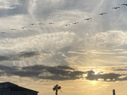
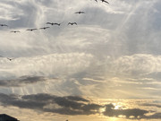
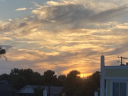
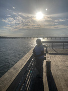
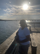
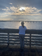
So we headed back, throttled up to 5000 RPM and settled on plane at about 15 MPH to thread our way home. As we prepared to make approach to the marina at about 7 PM there were some really dark clouds rapidly moving in over Beaufort!!! No time to delay (or panic) but also there wasn’t going to be time for a fresh water wash-down or engine rinse. It was now high slack tide and we eased into our slip. Snagged the cleats on the first try. Dropped the Bimini and wrapped it. Engine up. Cushions in the cabin. Electrical shore cable plugged in. Battery charger on. Dehumidifier on. Nav chart plotter/sonar tucked in the backpack. Cabin locked up. Now a very quick walk (I’m too old to run anymore) up the ‘aluminum’ pier only stopping to take a couple quick photos. Then the wind reversed 180 degrees…a sure sign it was time to be elsewhere…. As having spent a dozen years in Mid/East Texas a strong wind reversal with low heavy fast moving clouds with lightning never means anything good. We got to the van with a bit of relief. Crossing the Hwy 21 McTeer Bridge we slowed down well below the speed limit as the wind gusts buffeted us a bit. The storm cell continued on without us and the rest of the trip home was uneventful.
As a kid growing up in Boy Scouts we had the motto “Be Prepared”.
As a City Medic in an East Texas City that was a boomtown gone bust we prepared for the worst.
As a Private Pilot you plan in contingency and alternative destination options into your flight plans.
As a R&D/Failure Analyst/High Tech/Aerospace Product Design Engineer you plan in redundancies.
Plan A -> Plan B -> Plan C —->>> as you use up one plan you move to the next and develop potential plans at least two or more steps ahead of where you are. Boating is much the same.
That and timing…Timing is everything. Timing is everything.
It’s always better to dodge or avoid an issue if possible rather than be caught up in it.
Monday was cutting it a bit closer than I would have liked.
The Admiral enjoyed the day out and about but was equally glad we made it back without having to weather any of the storms directly.
Welcome to South Eastern Coastal weather!
So much for a nice afternoon cruise on our beautiful local waterways and estuaries.
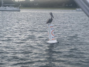
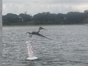
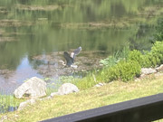
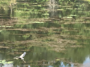
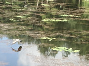
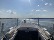
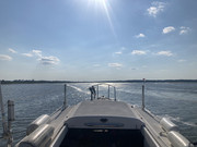
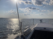
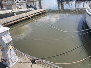
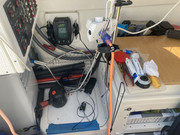
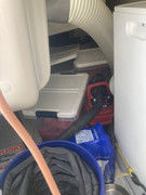
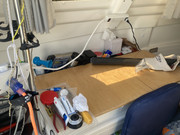
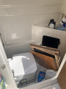
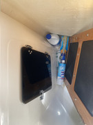
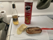
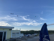
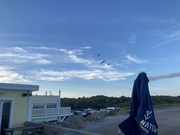
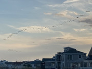
Here are a couple photos to share:
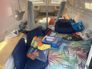
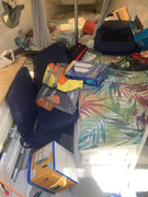
This week we’re planning on hauling out for a day to take care of some planned maintenance.
The engine oil and lower unit oil changes are nearly due and there are some other chores like swapping in our better chart plotter/sonar in preparation for our potential trips up to Charleston SC and down to Savanna GA before the end of season.
I’d like to upgrade our pedestal power outlets as well. The existing ‘marine grade’ outlets and plugs really haven’t held up as well as expected. I’ve got a pair of new ‘5 Year Warranty’ Marino sockets and plugs ready to replace the current ones.
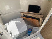
Hopefully the newer ones do/last better. Would also like to install the Day/Night Vent Fan into the side window of the head for better ventilation as an extractor. It will also be a good time to check the operation and condition of the swing keel and lift line. Checking our hulls bottom paint condition is also on the list. It’s been two full seasons now since it was applied and we’ve put many enjoyable water miles under our hull both on Lake Champlain and on our Southern estuaries.
Best Regards,
Over Easy


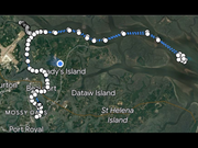
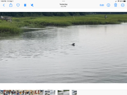
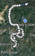
PS: Log map of our travels. Approximately 54 miles


 that killed millions, and other personal health issues???)
 Actually a good portion of IT already IS theirs
  !
! ).
).
 (
( unfortunately we were driving at the time and couldn’t snag a good photo to share


 ! Go figure!
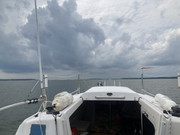


 🫣
🫣 .
. our new Suzuki 60 !!!
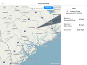


 .
.


 )
)

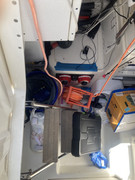
 Done - Oil from engine and lower unit looks great. No Problems.
 ).
).