Hello Group,
I finally got around to downloading Google Earth. Wow! What a cool program! The beta version for Windows is currently free. If you haven't downloaded it yet, you are missing out on a thrill. Go to Google. Click on the other offerings icon. Double click Google Earth. (They say that they are not yet supporting Macintosh.) I retraced "from above" my last couple of Mac vacations - North Channel, ON and Thousand Islands, NY. This program is amazing! You can see the bridge at Little Current is turned and letting the boats by. If you want to see my 26X, zoom in at
39 degrees, 03 minutes and 51.36 seconds N latitude, and
84 degrees 20 minutes and 44.29seconds west longitude. Without the CIA quality resolution, it looks like a big, white torpedo is in my backyard.
If the tree wasn't blocking the back end, you could see me seated on a stool changing the lower end fluid on the Honda engine....... maybe.
A space photo today would show it covered in a sheet of ice from this weekend's interesting weather.
All for now,
Dave "Jac"
P.S This summer, my family "bagged a 14er" in SW Colorado (We climbed Mt. Sneffels - between Telluride and Ouray). With Google Earth, you can tilt the image to show the mountain peaks. I could actually focus on the trail we took throught the knee-deep snow and slush.
A Mac 26X: Outer Space View
-
Dave X2000 Jac
- Chief Steward
- Posts: 50
- Joined: Wed Jun 09, 2004 4:26 pm
- Location: Cincinnati, Ohio

-
Lovekamp

- Deckhand
- Posts: 44
- Joined: Mon Apr 18, 2005 7:39 pm
- Location: Springfield, IL 2002 MacGregor 26X Nissan TLDI 50hp
I agree; I am truly amazed by this program: it has incredible detail. You can see the Eiffel Tower or the Tower of London. You can even see cable cars on the streets of San Francisco!
You can easily see a bunch of new :macm:s sitting outside at the MacGregor factory: 1631 Placentia, Costa Mesa, CA. Some are without the decks yet attached; it seems like that (being outside without a deck) wouldn't be a good thing.
On the other hand, I live in the middle of Illinois. I can zoom in on my neighborhood, but I can't even make out my house amid the blur. And GoogleEarth doesn't have a clue where Valencia, Spain, is. I checked to see what the America Cup village looks like; it put me on the Atlantic Ocean coast instead of the Mediterranean Sea!
-
Don T

- Admiral
- Posts: 1084
- Joined: Fri Jan 02, 2004 7:13 pm
- Sailboat: MacGregor 26X
- Location: 95 2600 "SS OTTER" - Portland OR - Tohatsu 50 - Hull#64 (May 95)
Hello:
You can go to the USGS.gov site and look at their pics too. They have the 2002 & 2004 fly over shots of Portland. Way better resolution than the space shots. In both years my Mac was sitting out in the driveway. The grass was green in the 02 shot so it must have been spring while I was preping for the San Juans. The 04 shows brown grass so it was July or August. Pretty cool, you can tell it's an X.
You can go to the USGS.gov site and look at their pics too. They have the 2002 & 2004 fly over shots of Portland. Way better resolution than the space shots. In both years my Mac was sitting out in the driveway. The grass was green in the 02 shot so it must have been spring while I was preping for the San Juans. The 04 shows brown grass so it was July or August. Pretty cool, you can tell it's an X.
Just a tip, guys. Ever since the last forum upgrade, the software is still shrinking images to 600x450, but only giving the click to enlarge in Preview, not when you go final. I've reported this to Heath, but he hasn't had time to find the problem.
To manually put in the option yourself, enter the code for the picture like this:
For example,

Click on the image for the big picture
To manually put in the option yourself, enter the code for the picture like this:
Code: Select all
[url=http://img.photobucket.com/albums/v296/procolharum/boat.jpg][img]http://img.photobucket.com/albums/v296/procolharum/boat.jpg[/img][/url]
Click on the image for the big picture
Click on the image for the big picture
-
Dave X2000 Jac
- Chief Steward
- Posts: 50
- Joined: Wed Jun 09, 2004 4:26 pm
- Location: Cincinnati, Ohio
-
Graham Carr

- First Officer
- Posts: 258
- Joined: Tue Feb 10, 2004 9:19 pm
- Sailboat: MacGregor 26X
- Location: Sedro-Woolley WA, 2002 26X , Mercury 50hp 4 Stroke Bigfoot "Pauka2"
You are looking at snapshots of the past. In fact at least parts of the Google Earth are from the pre spring 2002 time period. I base this on the following observations.
1. Longmont, Colorado; I can see my red truck sitting in the driveway and no boat on the side of my house. I purchased my boat during August of 2002. If the boat were gone, so would the truck. The leaves are just starting to bud out, indicating early spring.
2. Longmont, Colorado: I started a 2293 SF addition for a client on the South side of town during April 02. In the satellite image you can clearly see the foundation system that had just been completed. I document the construction process with date stamped digital photos. My photos place that part of the image during the first week of May 2002.
3. Boulder, Colorado: I had another small job just completing in the mountains above Boulder. You can see the black roof felt paper. The shingles were installed early June 2002
4. Burlington, Vermont: During the fall of 2004 I completed a large addition and this does not show up on the satellite image
5. Sedro-Woolley, Washington: The project I completed last summer also does not show upon the satellite image.
6. Orange City, Florida: My dads house, he built a small addition during the winter of 2004 and it does not show up.
7. New York, New York: I also checked out the World Trade Center ground zero area. You can see they have just finished the clean-up. They completed the main clean-up in May 2002.
I used the projects because they are a clear landmark and none of the mention locations a cover by trees. I was lucky all of the above locations were clear as a bell. But I still could not read my truck license plates .
.
I download both the standard and pro addition and found that they use the same satellite images. The website stated that they do some section updates, so it is possible the Macgregor factory is current. I think you are looking at the 26 X not the M.
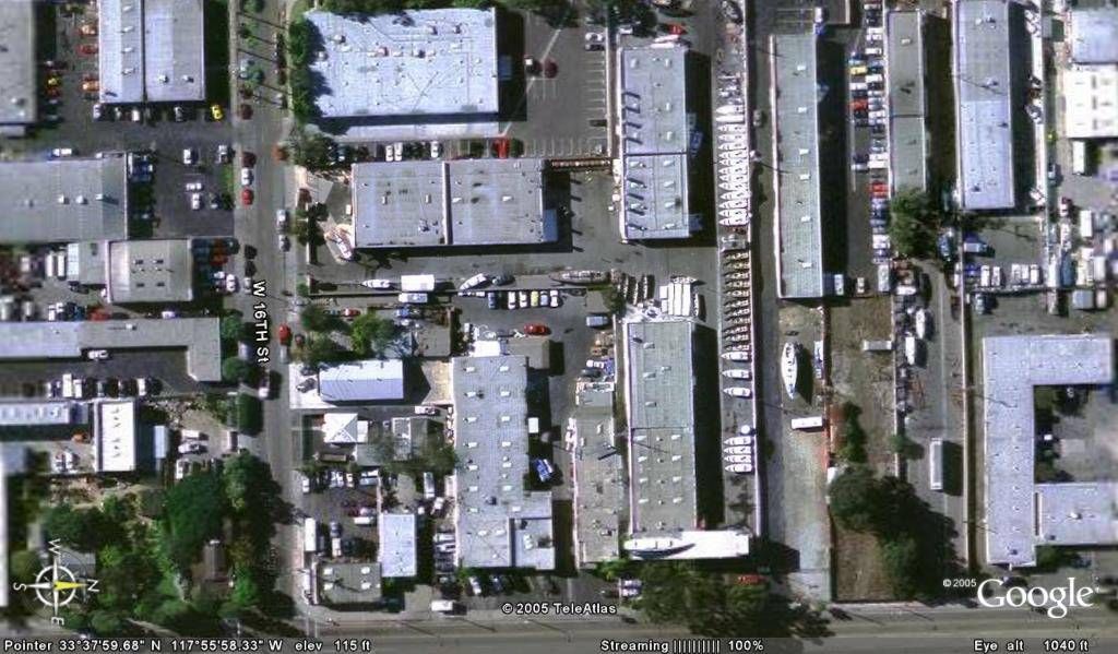
The other funny thing, I notice while I was looking at the Macgregor factory was it looked like a large boat was sitting on the roof. I looked at the brochure and sure enough thats a boat up there. Whats funny is all the time I have looked at the brochures and videos I never saw it. So I call Bill to find out the story behind this boat. He said it was the plug for the M65. They needed a place to store it so when they did a major remodel they incorporated it into the design. The curved roof line in front of the boat depicts a wave.
The satellite images might be old, but never the less it is still cool to look down from space!
Graham Carr
1. Longmont, Colorado; I can see my red truck sitting in the driveway and no boat on the side of my house. I purchased my boat during August of 2002. If the boat were gone, so would the truck. The leaves are just starting to bud out, indicating early spring.
2. Longmont, Colorado: I started a 2293 SF addition for a client on the South side of town during April 02. In the satellite image you can clearly see the foundation system that had just been completed. I document the construction process with date stamped digital photos. My photos place that part of the image during the first week of May 2002.
3. Boulder, Colorado: I had another small job just completing in the mountains above Boulder. You can see the black roof felt paper. The shingles were installed early June 2002
4. Burlington, Vermont: During the fall of 2004 I completed a large addition and this does not show up on the satellite image
5. Sedro-Woolley, Washington: The project I completed last summer also does not show upon the satellite image.
6. Orange City, Florida: My dads house, he built a small addition during the winter of 2004 and it does not show up.
7. New York, New York: I also checked out the World Trade Center ground zero area. You can see they have just finished the clean-up. They completed the main clean-up in May 2002.
I used the projects because they are a clear landmark and none of the mention locations a cover by trees. I was lucky all of the above locations were clear as a bell. But I still could not read my truck license plates
I download both the standard and pro addition and found that they use the same satellite images. The website stated that they do some section updates, so it is possible the Macgregor factory is current. I think you are looking at the 26 X not the M.
The other funny thing, I notice while I was looking at the Macgregor factory was it looked like a large boat was sitting on the roof. I looked at the brochure and sure enough thats a boat up there. Whats funny is all the time I have looked at the brochures and videos I never saw it. So I call Bill to find out the story behind this boat. He said it was the plug for the M65. They needed a place to store it so when they did a major remodel they incorporated it into the design. The curved roof line in front of the boat depicts a wave.
The satellite images might be old, but never the less it is still cool to look down from space!
Graham Carr
-
Don T
- Admiral
- Posts: 1084
- Joined: Fri Jan 02, 2004 7:13 pm
- Sailboat: MacGregor 26X
- Location: 95 2600 "SS OTTER" - Portland OR - Tohatsu 50 - Hull#64 (May 95)
Hello Dave:
For the USGS site click on "maps & publications" then scroll down to "The National Map" then click on "viewer." That puts you on the page where you can zoom in anywhere or click on "find a place" then "by address." Put in the address and zoom in.
It's a typical government site where you have to hunt for the obvious.
6339 se 84th Ave, Portland OR. will give you my mac sitting in the driveway.
On edit: You may have to click on "imagery" to view different overlays or layers of images.
Cheers
Last edited by Don T on Tue Dec 06, 2005 9:48 am, edited 1 time in total.
-
kmclemore

- Site Admin
- Posts: 6256
- Joined: Sun Feb 08, 2004 9:24 am
- Sailboat: MacGregor 26X
- Location: Ambler, PA -- MACX2018A898 w/ Suzuki DF60AV -- 78 BW Harpoon 4.6 -- 2018 Tahoe 550TF w/ 150 Merc
Thanks, Moe. Yeah, I use Mozilla, so unlike IE you can just right-click on the picture and select 'View Image'
and it will show you the whole thing. Thanks for the code suggestion!
BTW, I might note that this is officially my one-thousandth posting.
Ahem.... woopee.
You may all now get down on one knee and address me as "Admiral" and I will humbly accept your supplication.
and it will show you the whole thing. Thanks for the code suggestion!
BTW, I might note that this is officially my one-thousandth posting.
Ahem.... woopee.
You may all now get down on one knee and address me as "Admiral" and I will humbly accept your supplication.
-
waternwaves
- Admiral
- Posts: 1499
- Joined: Wed Oct 13, 2004 8:18 pm
- Location: X less in North Puget Sound -have to sail other boats for a while

Google Earth is truly awesome. The pan and tilt feature is about the coolest thing ever. Honestly it's the first computer App I've been truly excited about in years.
Side note to the question of image dates... there's always a copyright year showing on the image, and it frequently changes depending on the source and capture date for a given area. I can't say if it's the actual date of the image, but it surely distinguishes between
"old" and "new" images.
PS -- Admiral Kevin, Congratulations on your promotion. The crew is standing by for it's orders.
-
kmclemore
- Site Admin
- Posts: 6256
- Joined: Sun Feb 08, 2004 9:24 am
- Sailboat: MacGregor 26X
- Location: Ambler, PA -- MACX2018A898 w/ Suzuki DF60AV -- 78 BW Harpoon 4.6 -- 2018 Tahoe 550TF w/ 150 Merc
Yeah, I'm with you, Zavala - this app is definitely a killer app. As you can see by the pictures above,
I've been using it for quite some time now, from way back when it was still 'Keyhole'
(i.e. before Google bought them).
I often use it to 'tour' areas where I will be boating with the Mac.. works really great
to get the feel of the area. Also works well when you've got to drive to a new area or locate a
particular site or building and you need more than what a map can offer.
And as for the 'orders'... I'll have a cheese-steak with, please.

-
Graham Carr
- First Officer
- Posts: 258
- Joined: Tue Feb 10, 2004 9:19 pm
- Sailboat: MacGregor 26X
- Location: Sedro-Woolley WA, 2002 26X , Mercury 50hp 4 Stroke Bigfoot "Pauka2"
I can only comment on the locations I mentioned above. Yes they had a copyright year, 2005. So the old images still had 2005. Now my shots were taken from Google, but I noticed some of the other post pics have keyhole.com in the lower right corner. I tried that site but it went to the Google  . So just to clarify, the shots I was referring to were in fact Google. Kmclemore were did you find them?
Graham Carr
Graham Carr