

Sail Mag this month has an article citing "the demise of paper charts"
The more I sail in coastal conditions, the more I think paper charts are a necessity. When you need to get a quick fix, I find there are too many buttons and menus on my GPS to fiddle with - in addition, my crew are even less adept at the GPS than I.
My 10 year old can take a fix and plot on a chart, in contrast.
This sailor will always have up to date paper backups.
"the demise of paper charts
-
K9Kampers
- Admiral
- Posts: 2441
- Joined: Thu Apr 13, 2006 7:32 am
- Sailboat: MacGregor 26X
- Location: NH, former 26X owner
Steve - I've not yet seen the article. Were they reporting on a planned discontinuation of paper charts, or predicting the triumph of technology over paper in the way that computers in the home/workplace were supposed to reduce our paper usage?
I'm with you on the paper vs. GPS idea, in the type of sailing I do - lake & coastal. Buttons, menus, zoom +/-, small screen... Plus, the way I helm, aside of & slightly forward of the helm pedastal, the GPS (Garmin 76) mount on top of the pedastal is never convenient. I end up using the GPS to check my speed and lately have had it sitting in the swivel drink holders, either side of the pedastal.
Currently, I prefer papercharts, but known that I have to get proficient with GPS. Haven't had to deal with issues such as fog yet!
-
bastonjock

- Admiral
- Posts: 1161
- Joined: Fri May 25, 2007 10:41 pm
- Location: Lincolnshire United Kingdom Mac 26X


We have a laptop...downloaded all the free Maptech charts....purchased a Maptech Chartbook or 2 and got a DVD copy of Off Shore Navigator Lite..free....this a program you need to make your GPS compatable to your laptop and free charts....also purchased a cord that connects the GPS to the laptop and 12v so you can run it continously without batteries...tried it out on the St Johns River...pretty neat watching yourself travel up the river....
The chartbook and free DVD were $44.95 +SH (N.J Coast) and the "PC interface with vehicle power cable" was $45 + SH....so for a little over a $100 I am able to use my laptop and GPS.....Granted....it's not as great as a chartplotter...but much cheaper ..if you already have the laptop..
We have chartbooks or papercharts for all the places we cruise.....the Maptech charts will be great for busy areas etc...and fun....but I'd hate to have a computer crash and be depending on that only...
Carol & Jim
"Lingerawhile" 28' Adventure Craft (former X owner)
Its pretty hard to comprehend how Sail would take a position like this. I have not read the article but it seems hard to comprehend how they could advocate navigating by electronic means alone.
I just did a 28 mile run along the California/Mexico coast at night with a top of the line Raymarine GPS/chartplotter. It is an absolutely incredible piece of technology. However, I found myself continually verifying its accuracy with paper.
I will give technology credit though. There are massive kelp beds that extend off of Point Loma in San Diego. The chart plotter did an excellent job in keeping us out of them.
Still..what happens when the unit or battery craps out while en route. Better have the paper!
-
richandlori

- Admiral
- Posts: 1695
- Joined: Wed Aug 18, 2004 8:08 pm
- Location: Living Aboard in Morro Bay, CA
- Contact:
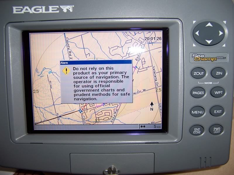
The demise of Paper Charts is simply a reflection of the demise of Seamanship.
There we were in Turtle Bay Mexico at anchor after a 78hr sail from San Diego. As we were having breakfast in the cockpit we were watching a 40ft something boat attempt to anchor. After the forth attempt, a voice came over the VHF asking for advice on getting the anchor set because this was "their first time anchoring"! No exaggeration! We were 350miles South of San Diego and the captain of the ship abd crew had not anchored before!
The death of paperchrts is a reflection of people not taking the time to learn the necessary skills in reading a chart and plotting, the dumbing down of Seamanship. Who doesn't want to have all the information easily displayed and calculated for you on a 6inch color screen, but on a boat, you will lose your electronics some day, and when that day comes the sea will not forgive a fool.
-
Catigale

- Site Admin
- Posts: 10421
- Joined: Fri Jun 11, 2004 5:59 pm
- Sailboat: MacGregor 26X
- Location: Admiral .............Catigale 2002X.......Lots of Harpoon Hobie 16 Skiffs....Island 17
- Contact:
Reminds me of:
Charter Boat: CB hailing Charter Base - we are out of anchors, over.
Charter Base: Charter Base here. You should have three on board, over.
Charter Boat: Copy that Charter base, but its our Fourth night out, over.
.........silence...........
(it might be an urban legend but its a durn good one....)
I read the Sail article and they are not advocating doing away with paper charts. It's simply the opinion of one circumnavigator who relies exclusively, it seems, on electronic charts.
I like the GPS and use it every time to see my track, speed, distance, etc., but I always use paper charts at the same time. My hand-held GPS is about 2 inches by 3 inches; hardly sufficient to show much of the surrounding area. Also, in the sun it is difficult to see the screen sometimes, and the GPS does eat up batteries.
I think paper charts will always be here because they are more user-friendly. You can see a large area at one time, you can draw on it quickly, I can use it in the cockpit, etc. So both GPS and charts have their place.
-
Duane Dunn, Allegro

- Admiral
- Posts: 2459
- Joined: Fri Jan 02, 2004 6:41 pm
- Sailboat: MacGregor 26X
- Location: Bellevue, Wa '96 26x, Tohatsu 90 TLDI and Plug In Hybrid Electric drive
- Contact:
I use GPS based charts exclusively. I have paper charts on board, but they are mostly just for show. Occasionally I'll get them out over a dinner conversation, but never for under way navigation.
With a proper sized GPS chartplotter (micro screen handhelds need not apply) there are no problems at all seeing vast area's around your boat. Want more info, split the screen and put a close up view in one window and a overview in the other. My chartplotter can swivel to face any direction in the cockpit. I can sit anywhere and still see it. Of course it does often block the view of another un-used relic in the cockpit, my compass.
The chartplotter easily provides information on the surrounding area in great detail (no digging out that harbor chart required), it shows me precisely where I am and where I am headed (even when I will get there). I can pan and zoom far faster than I can turn paper pages. It shows me exactly how my actual course compares to the planned route I was going to follow. It gives me far better situational awareness than can ever be had with paper charts. Notes are not a problem, add all you want. The chartplotter will plot a course to the May-Day signal coordinates received through the DSC VHF link with no problem. It will even show you the exact current state where the boat in trouble is and will let the autopilot drive you there while you prepare for the rescue.
Throw in all the extra information it provides; actual depth; speed over ground; speed through water; tide state; current state; and even temperature; and I know more about where I am and what factors can impact the operation of the boat than I ever could with paper alone.
I don't need to take a periodic fix, I have a fix constantly showing me exactly where I am with much more precision than I could ever get with a handbearing compass, rule and dividers (it usually even shows the exact slip in the marina). By the time you get your fixes plotted the old way you are no longer where you were to begin with. Plus all that heads down time means you are not looking around for danger (not to mention there isn't even a unused flat surface in my boat to put a chart on).
Using a GPS chartplotter will increase your safety while operating your boat tremendously. It will also lower your blood pressure in uncertain conditions. I'd never rely on the paper way as the primary method of navigation. It's the third choice, last resort alternative, behind the primary GPS plotter and the handheld GPS / computer backup option. Why deal with the stress of paper navigation when you are out on the water to relax?
-
Chinook

- Admiral
- Posts: 1730
- Joined: Sun Feb 26, 2006 7:20 pm
- Location: LeavenworthWA 2002 26x, Suzuki DF60A
I thoroughly concur with Duane's description of the benefits and advantages of GPS and chartplotters. However, I value paper charts for another set of reasons which are compelling for me. First is the obvious value of having something that isn't vulnerable to electronic failure. Beyond that, I just like working with paper charts. Our cruises begin months prior to actual boat launch. I enjoy studying the prospective route ahead of time, learning where possible hazards might be, marking and measuring distances between sources of supply, trying to identify the most attractive anchorages. I find this much more satisfying when done with paper charts. I can mark things, make notes, plot tentative courses and distances, and prepare GPS lists to be entered into the Garmin. This gives me good familiarity with the cruising grounds well in advance of the trip. I find paper charts ideally suited for these purposes.
On the water, I always have my paper chart in the cockpit and available for ready reference. The course line is drawn in, and advance waypoints marked on the paper, as well as in the GPS. Periodicly I advance a little sticky arrow, marking our position. Another crew member can glance at the paper chart and identify our position. This approach allows me to easily look ahead without having to mess with the buttons and features of the electronic gizmo. The paper charts sometimes have greater detail, and I find them easier to read than the electronic display.
On our Alaska cruise, good chartbook coverage wasn't available for much of the planned route, and I balked at buying all the paper charts, which could have easily totalled over $1000. Storage and organization of that huge stack of paper would have also been a problem. My solution was to work with the Maptech electronic charts for coastal BC and SE Alaska. The winter before the trip, I printed off sections of the e-charts that we expected to cruise through, using regular paper and ink. I slipped them into clear plastic sleeves and 3 ring binders, numbered the pages, and wrote in the page numbers for adjacent pages. These homemade chartbooks worked great, and the paper/ink cost was well below the cost of buying charts. The time factor was considerable, but I enjoyed working on them and learning about the route.
-
Duane Dunn, Allegro
- Admiral
- Posts: 2459
- Joined: Fri Jan 02, 2004 6:41 pm
- Sailboat: MacGregor 26X
- Location: Bellevue, Wa '96 26x, Tohatsu 90 TLDI and Plug In Hybrid Electric drive
- Contact:
I'm a dream and plan-a-holic as well, but I do it all on my laptop
( http://www.memory-map.com/navigator.htm ).
I can mark up the charts with routes and notes to my hearts content. When I finish dreaming, the route goes on the SD memory card and right into my chartplotter on board (as well as my Pocket PC). Now I am ready to sit back and enjoy the ride as the autopilot follows the course. By default I also now have it in the laptop whose real onboard job is to play movies but can be up and running with the handheld Etrex GPS if needed.
Cost is also an issue. A full set of Puget Sound charts is not a trivial expense. You would think the Canadian ones were printed in gold.
I've also got even more redundancy on board as I mounted my old Lowrance chartplotter (black and white) in a corner below when I installed my new big screen color plotter at the pedestal.
Add to that my Pocket PC which I always have on board and the Bluetooth GPS used mainly in the car with my Blackberry and Google Maps but just as servicable with the Pocket PC or the computer. If only they would get charts as a layer on google maps like they do for the satellite photos.
That makes paper my fifth line option.
This is the exact PPC I use in an Otter Box waterproof case.